• Discover new ways to elevate your game with the updated DGCourseReview app!
    It's entirely free and enhanced with features shaped by user feedback to ensure your best experience on the course. (App Store or Google Play)

Measuring Feet

Actually, a step is about a yard; a pace is two steps. Specifically, the distance from the where the right heel strikes the ground to the next strike. The mile is 5,280 feet because it is 1000 standardized Roman paces. (People were shorter then.) A pace is used because the heel strikes of one foot go in a straight line, while the heel strikes of alternating feet make a somewhat zig zag line.

Uh … nope.

The standardized Roman pace was 5 Roman pedes, roughly 1.48 meters/4'-10.2", so 1000 standardized Roman paces = ~1480 meters/4850'.

The statute mile is 5280' because in 1593 the English Parliament, via the Weights and Measures Act, decreed the English statute mile to be equal to eight furlongs of forty poles, each pole being 16½', in length. (See [/I]Statutes at large from the first year of King Edward the fourth to the end of the reign of Queen Elizabeth. Vol. II. 1763, Act 35, Eliz. I, cap. 6, s.8, p. 676.)

OK, well, sure, if you're going to look things up. (Kids today don't know how to rely on vague memories of things they think they heard. Dagnabbit.)

To save some face, from the Encyclopædia Britannica:

"Mile, any of various units of distance, such as the statute mile of 5,280 feet (1.609 km). It originated from the Roman mille passus, or "thousand paces," which measured 5,000 Roman feet."

Anyway... nobody's step measures 5 feet or 1.48 meters, so a pace is still two steps (even though it is very easy to find sources on the internet that say otherwise, so don't bother, anyone).
 
The problem with reels is the disc flies through the air, not on the ground -- unless you're throwing a roller.
It doesn't fly in a straight line either.

Also when doing dogleg holes that go around water or impenetrable trees, you're supposed to use the path of the fairway to measure the official distance, not the beeline distance. A laser rangefinder ain't gonna help you there.
 
It doesn't fly in a straight line either.

Also when doing dogleg holes that go around water or impenetrable trees, you're supposed to use the path of the fairway to measure the official distance, not the beeline distance. A laser rangefinder ain't gonna help you there.

You missed my post earlier in the thread about measuring line of sight and the fairway.

Yes a rangefinder can measure anything, it's easiest with 2 people. One to shoot the laser and the other to be the target. It helps if the target person is holding something more reflective like a metal sign -- but depending on the distance and the particular rangefinder being used that may not be necessary.
 
OK, well, sure, if you're going to look things up. (Kids today don't know how to rely on vague memories of things they think they heard. Dagnabbit.)

To save some face, from the Encyclopædia Britannica:

"Mile, any of various units of distance, such as the statute mile of 5,280 feet (1.609 km). It originated from the Roman mille passus, or "thousand paces," which measured 5,000 Roman feet."

5000 Roman feet =/= 5280 feet.

That quote simply states that the designation "mile" as a measure of length is derived from the mille passus. It in no way supports the conclusion that the mile is 5280' because 5280' is the length of 1000 paces.

[/quote]Anyway... nobody's step measures 5 feet or 1.48 meters, so a pace is still two steps [/quote]

The meaning of words evolves, and usus loquendi trumps etymology all day, every day.

A "pace" may have been defined as the length of two steps in Roman classical antiquity, and that definition may still hold in historical studies and for legal purposes in certain narrowly defined technical fields such as surveying, but we ain't living in Roman classical antiquity, and outside of legal contexts, the meaning of "pace" has clearly evolved—even in military contexts (try telling your DI a pace is two steps and see where that gets you)—to mean the length of a single step.
 
It doesn't fly in a straight line either.

Also when doing dogleg holes that go around water or impenetrable trees, you're supposed to use the path of the fairway to measure the official distance, not the beeline distance. A laser rangefinder ain't gonna help you there.

measuring in segments with the rangefinder is still better than any other option.
 
Now that you're allowed to measure distance while playing rounds, owning a rangefinder makes even more sense.
 
Just a general question...if measuring distance do you measure from the tee, around obstacles and such to the basket? Or do you measure as the crow flies, straight from tee to basket in a line.

Par 3's should be straight line since there is intended to be a single shot to reach the green.

Par 4's should be the distance to the intended drive landing spot plus the distance from that point to the center of the green.
As mentioned earlier, if you can give both, that's even better.
 
Par 3's should be straight line since there is intended to be a single shot to reach the green.

Par 4's should be the distance to the intended drive landing spot plus the distance from that point to the center of the green.

As mentioned earlier, if you can give both, that's even better.

Not entirely right for either. There can be 2-shot par 3s with a jog in the flight line. And for par 4s with a long carry over water, the desired landing zone may be off to the side but big arms might be able to go straight across. So you measure straight line distance in that case.
 
I'm curious where the OP is located. Perhaps there are local DG'ers that would be willing to help out with the tools and labor associated with measuring out and mapping a course. One of the things that keeps me from playing DG all the time is my job which often involves the survey of wooded areas and production of maps for various clients. I've always thought it would be fun to combine the two, and I'm sure others out there would feel the same way.
 
Par 3's should be straight line since there is intended to be a single shot to reach the green.

Par 4's should be the distance to the intended drive landing spot plus the distance from that point to the center of the green.

That's how ball golfers complete a ball golf hole. The same idea doesn't apply to a disc golf hole since a scratch disc golfer in most cases will only need one putt once they've reached the so called "green".
 
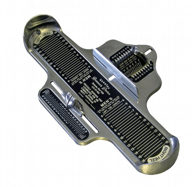
Am I the only one that read the thread title, and thought this ?

brannock_device.gif
 
That's how ball golfers complete a ball golf hole. The same idea doesn't apply to a disc golf hole since a scratch disc golfer in most cases will only need one putt once they've reached the so called "green".

What does that have to do with how long the hole is?:confused:
 
You could upload google earth imagery into google sketchup and then accurately measure each hole's intended flight path or just direct line from tee to target. I believe you can use google earth to find changes in elevation, as well (i haven't used this feature but I THINK i have seen it somewhere). This is all FREE btw.
 
For the courses I've been involved with we used both a wheel and google earth, and averaged the distances, and the rounded to the nearest 5. If we got a massive difference between the two we went over it several times with each until the results looked more consistent.

The wooded holes get difficult on google earth, anything going over water complicates the wheel. We had one hole we relied completely wheel because we couldn't see it under the trees, and one we had to estimate on the wheel because of water. It is easy to pick the wrong spots on google earth, especially if its an older image of the area before you cleaned it up. But using the two you'll usually get close enough for disc golfers.
 
Top